Our first experience of a highpointing road trip began in late December 2014. We packed the car and set out on a 1,500+ mile circular route around New England that would take in each state highpoint.
We would warm up slowly with the first summit at sub 1,000 feet elevation.
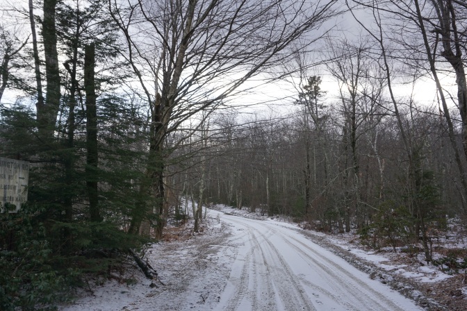
Jerimoth Hill, Rhode Island
There were three fears. It was dark. It was raining. It was windy. And some information talked of private property, of barbed wire fences. The rain slashed highway still revealed a sign and an elevation, which could only bode well. The trail was cut through the woods and a few minutes along, a small boulder poked out of the earth, revealing itself as standing inches above all of the rest of Rhode Island.
The six summits in winter were truly underway.
")
")
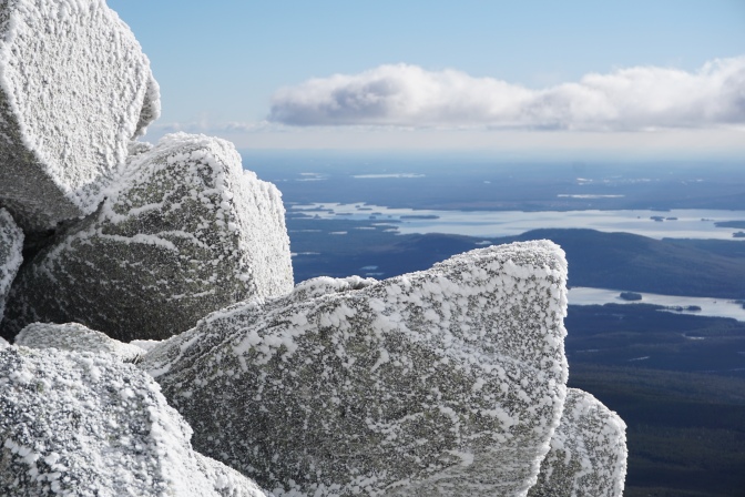
Mount Katahdin, Maine
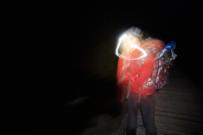
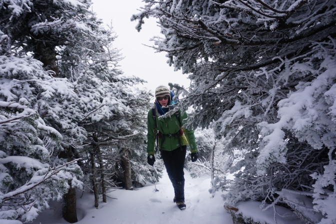
There was a rime of ice around the top of the sleeping bag. Sitting up dislodged ice crystals from the roof of the tent. The pot atop the stove was filled with a brick of ice. And it’s dark, the pre-dawn start necessitated by winter in Maine and a 3 mile walk just to get to the trailhead.
The direct winter route on Katahdin takes us straight up a steep, loose couloir, boulders half frozen in place connected by rivulets of ice. Looking up, clouds wreath the summit plateau and uncertainty is rife. Loose stones clatter off below our crampons and snow falls lightly from above.
At the crest the weather breaks, wind fades, shafts of sun shoot through the clouds and soon the top arrives, so sheathed in ice that scrapping the summit sign clean is the best confirmation we have arrived.
The 14 hours on the climb meant a collapse in the tent again was as close to comfort as we would get. At dawn the Maine woods were silent and the GPS was set for coffee. In the cafe, portions spilling over the sides of the plates were sized for woodsmen and fueled the day. There was nothing that looked like a straight road on the cross-country to New Hampshire and that is a welcome way to travel.
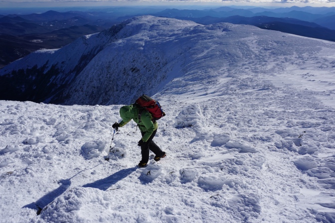
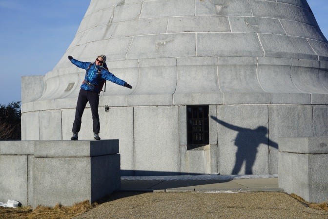
Mount Washington, New Hampshire
A group of us have climbed Mount Washington every winter for years – as a prelude to going to climb new routes on Vinson Massif in Antarctica, to test out gear before skiing in Greenland, or with no other objective than because it is always changing, always fun, and never fails to be windy.
The sharpness of the wind always hits on Lion Rock, the velocity magnifying to a point where tacking into it is preferred, shielding the face with a flapping hood and stepping from ice patch to ice patch to shield the crampons from completely dulling the points.
At the final ridge, sheltered by the top, the wind abated to a gentle roar, but cairns marking the way were encased in ice tentacles to create the new frozen world. The parking lot was skittered across, tarmac sheathed in an inch of ice. The sign at the top was as much a marker as something to hang onto and not fall over in the wind.
The retreat is always to the Nereledge Lodge, where an iron wood burning stove, a creaky floor and a big bath tub bring the limbs back to life. Three down and three to go.
Mount Mansfield, Vermont
It’s the Christmas season and Stowe bustles with skiers, with holiday makers, with SUV’s. The lodge has its last room for us and an indoor swimming pool, the restaurant down the road serves Sushi. Its a short break from the tents, burgers in roadside cafes and scraping the ice off the car every morning.
The ski lift at Stowe will take you close to the summit, but that just doesn’t seem appropriate. The trail through the forest can only be described as intermediate, so little more than a good warm up to the final ridge.
The forest rapidly turns from dense deep green with a tight path cut through the trees, to wind blasted granite. Ice fills the cracks, ice cuts through the jacket, ice axes suddenly become relevant and shuffling uphill like beetles the best strategy for advancement to the top of Vermont.
Wind blasts the cheeks white in seconds and we scramble down for the security of the forest. At the car we toss the down jackets in the back, take a breath, reset the GPS, we are headed south for the winter.
Mount Greylock, Massachusetts
Thinking the major challenges are behind us, we debated running shoes or boots, choosing the latter. An hour later, as frozen ground turned to ice sheets, just leaving the crampons behind began to seem an oversight. A combination of brush grappling and tree clutching soon got us over the crux, and after navigating the ubiquitous ice sheathed parking lot, arrived in blue sky brilliance atop Massachusetts.
The plinth at the summit belied our lonely struggle, the facilities boarded over and closed for the season. We switched from tree grabbing to tree rappelling for a rapid descent back to the valley.
Mount Frissell, Connecticut
The tallest peak in CT is Bear Mountain. But the tallest point is on a ridge leading out of the state into Massachusetts, so point it must be. Winter road closures soon had us wandering back roads, seems even access this time of year could be a challenge. And the parking area, not to disappoint, was a skating rink we skidded across, nearly dropping a car into the woods before we even started.
Reaching the Frissell ridge while still in Massachusetts, we then descended to the border with Connecticut, making this the first mountain we climbed where you had to climb down to reach the high point.
Then we set the GPS for home. No more roads, no more peaks. Or at least for a little while. We needed a new adventure.